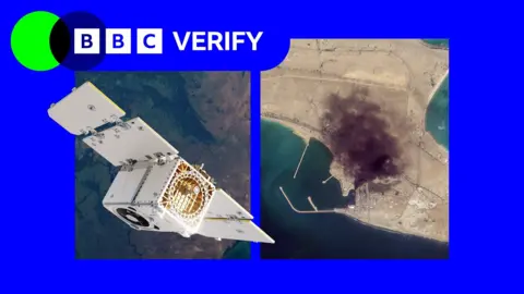
In a controversial move, satellite imagery provider Planet Labs has decided to limit access to its images of Iran due to pressure from the US government. Originally implementing a 14-day delay in March, the company has since moved to an indefinite restriction. This decision has raised alarm among humanitarian groups and journalists, who rely on such imagery to monitor the impacts of ongoing military conflicts, including the US-Israel war with Iran.
The US Department of Defense did not respond to inquiries regarding the reasoning behind its request for the restrictions, leaving many questions unanswered. Planet Labs previously justified its original policy change as a means to prevent adversaries from using their images tactically against allied forces.
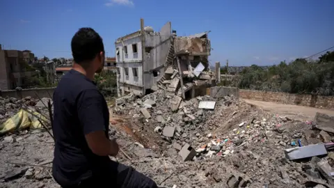
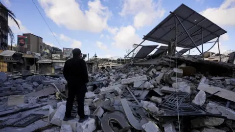
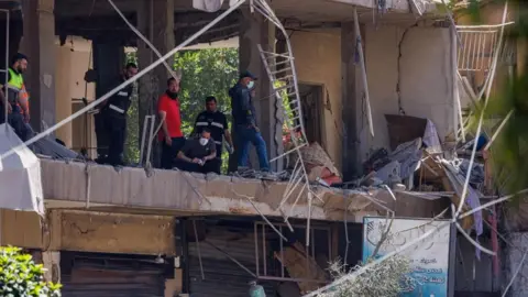
The new restriction means that images captured after March 9 are no longer regularly available, severely impacting journalists' and analysts' abilities to assess damage to both military and civilian infrastructure in the region.
Experts have noted that the limitations not only affect journalistic efforts but also hinder humanitarian organizations, such as Oxfam, which use satellite imagery to plan logistics and coordinate aid during conflicts. The shared concern is that when access to vital satellite data disappears, it obstructs crucial humanitarian efforts and the evaluation of human rights situations.
Amid the limitations, analysts believe that the nature of satellite technology is evolving, suggesting that these restrictions may become increasingly futile as new providers emerge worldwide. Todd Harrison, a former US Air Force captain, reflected on the potential implications of such compliance for global military operations and strategies. The growing accessibility of dual-use technology means that both sides of a conflict have heightened awareness of battlefield developments, forcing governments to adapt their military planning.
The US Department of Defense did not respond to inquiries regarding the reasoning behind its request for the restrictions, leaving many questions unanswered. Planet Labs previously justified its original policy change as a means to prevent adversaries from using their images tactically against allied forces.
The new restriction means that images captured after March 9 are no longer regularly available, severely impacting journalists' and analysts' abilities to assess damage to both military and civilian infrastructure in the region.
Experts have noted that the limitations not only affect journalistic efforts but also hinder humanitarian organizations, such as Oxfam, which use satellite imagery to plan logistics and coordinate aid during conflicts. The shared concern is that when access to vital satellite data disappears, it obstructs crucial humanitarian efforts and the evaluation of human rights situations.
Amid the limitations, analysts believe that the nature of satellite technology is evolving, suggesting that these restrictions may become increasingly futile as new providers emerge worldwide. Todd Harrison, a former US Air Force captain, reflected on the potential implications of such compliance for global military operations and strategies. The growing accessibility of dual-use technology means that both sides of a conflict have heightened awareness of battlefield developments, forcing governments to adapt their military planning.