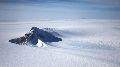
A new map has unmasked the landscape beneath Antarctica's ice in unprecedented detail, something scientists say could greatly enhance our understanding of the frozen continent.
Researchers used satellite data and the physics of how Antarctica's glaciers move to determine what the continent might look like beneath the ice. They found evidence of thousands of previously undiscovered hills and ridges, and the maps of Antarctica's hidden mountain ranges are now clearer than ever.
While these maps are subject to uncertainties, the researchers believe the new details could shed light on how Antarctica will respond to climate change and what that means for sea-level rise. It's like before you had a grainy pixel film camera, and now you've got a properly zoomed-in digital image of what's really going on, said Dr Helen Ockenden, highlighting the importance of this research.
Traditionally, measurements from the ground or air used radar to 'see' beneath the ice, often leaving large gaps in our understanding. However, this new satellite approach reveals previously hidden landscapes, which is pivotal for predicting future changes as the planet continues to warm.
This new map is considered to be the most complete ever made of Antarctica’s underlying topography, enhancing our ability to understand the dynamics between the ice and the land underneath.